
When we had the opportunity to visit Senja in Norway, I wanted to focus on two things: hiking and camping. We’d be spending a few days in Oslo before heading north, and I was ready to be fully surrounded by the natural beauty this Northern Norway island had to offer after a few days in the city.
The hike up Segla is about 3 miles round trip and took us 3-4 hours to complete, including a lunch break at the top.

If you’re planning a trip to Senja and hiking is on your itinerary, Segla is likely one of the mountains you’ll come across. To get to there, make your way toward Fjordgård and keep left after the tunnel. Head up the road behind Segla Grill (a great option for a post-hike lunch!) and past the school you’ll find the trailhead. Parking is available along the road and this is the starting point for a few different trails. We opted to hike Segla itself, but to get the view of Segla that’s been popularized on social media you’ll have to take a nearby trail to the top of Hesten instead. There were directions at the trailhead to find it.

This hike starts out slow, gradually winding through a lightly wooded landscape before leading to a rockier incline. It flattens out for a bit at a grassy ridge, with the steep trail to the top of Segla in one direction, and an alternate route to a different peak (Barden) and back down to the parking area in the other (heading out this way would be a great option to extend your hike if you have the time!)

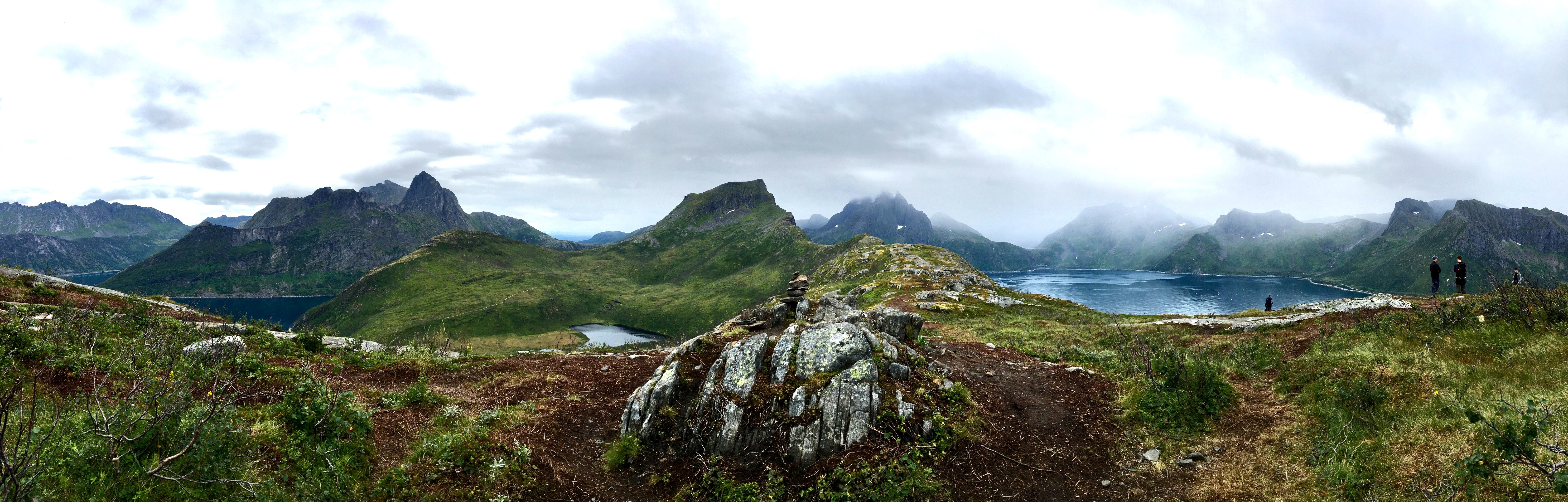
We stopped for a minor breather along the ridge, taking in the scenery and readying ourselves for the climb ahead. This plateau, with beautiful views in all directions, is a great spot for a picnic, either before or after summiting Segla.

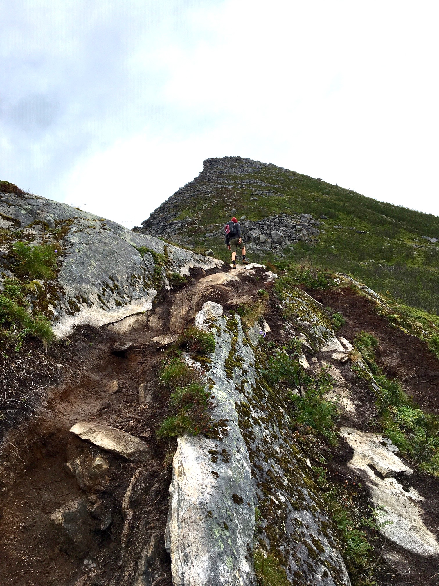
The next part is where things get challenging. I’m not into heights. I’ve climbed some steep mountains, but they’re usually peppered with enough trees that I don’t have to stare out at just how far I could possibly fall if I were to lose my footing. While I stopped regularly to fully appreciate the beauty around me, I was mostly staring at the path ahead, planning my next step. When my eyes wandered back the way we’d come, my heart started beating a little faster and I’d find myself holding my breath.

There’s no clearly marked trail to the peak. Some paths seem more worn than others, but ultimately you’re climbing over boulders at what I’d guess to be a 45 degree incline, and I made my own path over areas that seemed to offer the sturdiest footing.
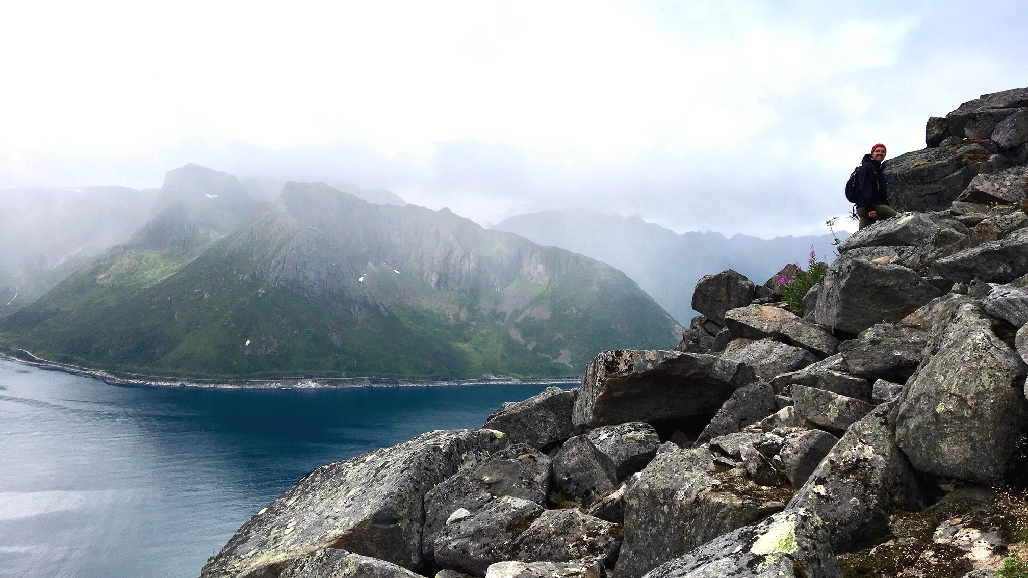
Dan made it to the very top. As things got more narrow, I opted to hang back for the final bit, finding myself as close to that sheer drop into the water below as I wanted to get. I know I’m a Nervous Nelly, but in all seriousness, be careful on this hike. There are steep ledges that drop straight to the ocean in multiple places, and they can sneak up on you, as I quickly learned when trying to give some hikers who had packed a picnic space to eat their lunch.

Clouds rolled in as we were at the top of the mountain, accompanied by a light mist that only made the steep climb down a little more terrifying. While I made nervous conversation with the first few people I passed on my way down (“A little more terrifying heading down than up!”) I became more confident with every step, realizing that my feet were in fact landing solidly in front of me, and that I was slowly overcoming the fear that kept tricking me into thinking my limbs were going to somehow give out, causing me to plummet over the edge of a cliff.
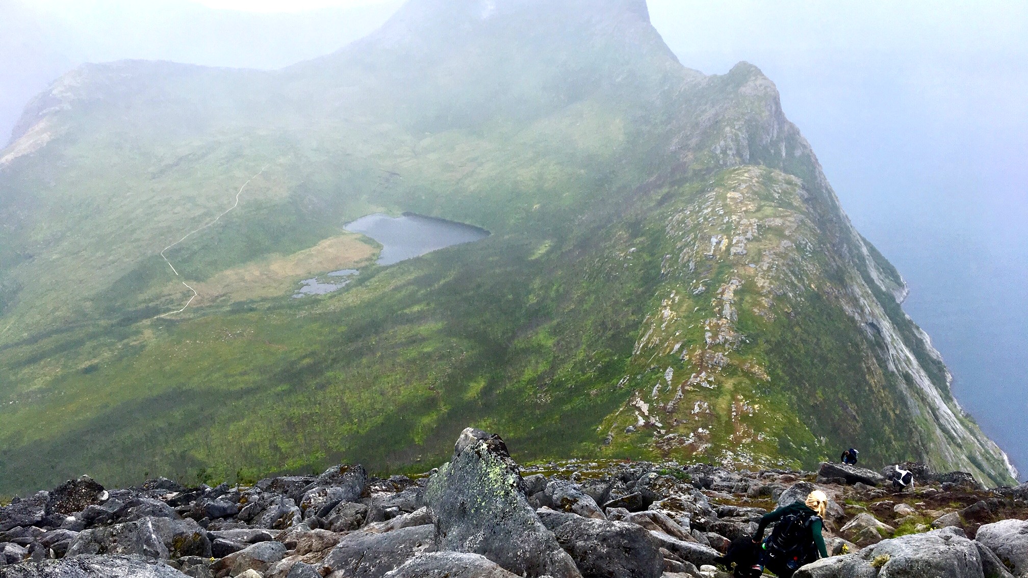
I felt a great sense of accomplishment as I reached the plateau below. It may be cliche, but it’s never more true than in times like these – those things that challenge you most are, ultimately, the most rewarding.

